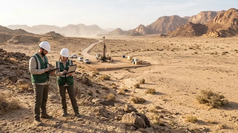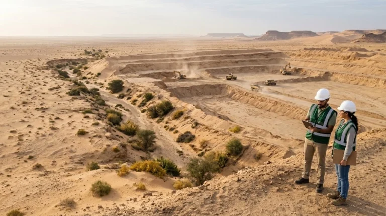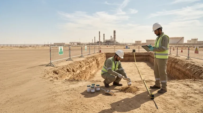
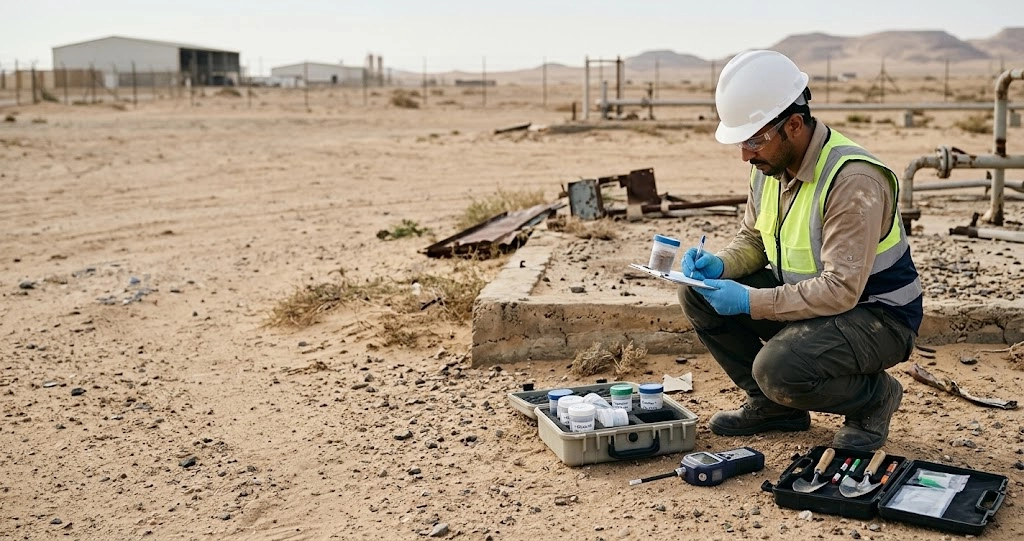

The field environmental survey helps project owners, government agencies, and industrial facilities understand the condition of damaged sites before development, remediation, or reuse. It combines site history review, inspection, sampling, analysis, and mapping results to identify potential sources of contamination, pathways of migration, and areas requiring further investigation. This guide explains the execution steps, soil, water, and air testing, data quality and reporting requirements, and how to define an appropriate scope of service for the site and the decision required before implementation.
Short answer: Assessing a damaged site begins by defining the environmental question that needs to be resolved, followed by a review of past uses, site inspection, and designing an appropriate sampling program. Results are interpreted according to the environmental medium, proposed land use, and the competent authority's requirements, while specifying the limitations of the investigation and the need for further study or remediation.
What is a field environmental survey and how does it differ from other studies?
A field environmental survey is a program to collect traceable data on the site's condition and potential sources of contamination. It may include soil, water, dust, air, and residual materials, depending on past activity, the nature of the incident, and the study objectives. The desired outcome is evidence-based understanding that helps the owner make a specific decision.
This task differs from a simple visual visit or collecting a set of isolated analyses; every measurement point must be linked to the reason for its selection and the decision it supports.
| Study | The question you are answering | Typical output |
|---|---|---|
| Field Environmental Survey | What is the site condition and what data is needed to understand it? | Observations, measurements, samples, and maps |
| Contaminated site assessment | Where is the contamination, what is its extent, and what are the exposure pathways? | Interpretation of the situation and recommendations for investigation or remediation |
| Environmental impact assessment | What are the impacts of the project and how can they be managed? | A study supporting planning and applicable environmental requirements |
| Periodic monitoring | How do indicators change over time? | A series of results and follow-up reports |
| Post-remediation verification | Have the specified remediation goals been achieved? | Verification results and recommendations for the next step |
A survey can feed into a broader study, but it does not automatically replace it. To distinguish between a preliminary review and an investigation by sampling, see the guide Environmental Site Assessment and Phase I and Phase II stages.
When do you need to assess contaminated sites?
The need for assessment arises when there are reasons to suspect an environmental impact, or when a contractual or development decision depends on knowing the status of the site. The absence of odors or surface stains does not prove that buried layers are unaffected.
Some cases that deserve a review:
- Before purchasing land or changing its use: Especially land with a history of industrial, storage, or equipment maintenance use.
- After leaks: To identify released materials, spread areas, and media that may have been affected.
- After an industrial fire: To review burned materials, ash, firefighting water paths, and waste collection areas.
- Before closure or redevelopment: To understand the status of areas associated with tanks, drains, and previous operations.
- When unknown fill or unusual indicators are present: Such as buried materials, undocumented drainage, or changes requiring interpretation.
Work priority is determined based on the situation, proposed use, and potential receptors, such as workers, residents, or water resources. Access to a site affected by fire or demolition depends on appropriate safety arrangements and authorization; an environmental assessment does not replace a structural safety or site access assessment.
7 Phases for Conducting a Field Environmental Survey
1. Defining the study objective and the required decision
The reason for the investigation is determined: site purchase, reuse, identifying the extent of a leak, or verifying remediation. Available information and requirements are reviewed before selecting the number of samples or work equipment.
2. Reviewing site history and building a conceptual model
Records of usage, materials, incidents, blueprints, and available images are gathered. A model is then built linking the potential source to its pathway and the affected receptor. It helps Conceptual Site Model (CSM) to identify knowledge gaps and guide the investigation.
3. Site reconnaissance and identification of suspicious areas
The visit documents tanks, drains, fill, debris, stains, and storage areas. Accessibility, buried utilities, and work constraints are also reviewed, and areas that could not be inspected are recorded rather than ignored.
4. Preparing the sampling and analysis plan
The plan specifies the media, points, depths, contaminants, analytical methods, and quality control. The rationale for sample selection is explained, as well as how the investigation will expand if results require further action. There is no standard number that fits every area or activity.
5. Collecting and documenting samples
The identity, location, depth, time of collection, and conditions of each sample are recorded. Appropriate container, preservation, and transport arrangements are applied, along with a chain of custody that links the sample to the team, carrier, and laboratory, preventing record mix-ups.
6. Reviewing and interpreting result quality
Analytical methods, units, reporting limits, laboratory notes, and quality results are reviewed. Data is then interpreted within the site context, rather than merely making mechanical comparisons between numbers and reference values that may not apply to the case.
7. Preparing the report and determining the next step
The report outlines the findings, limitations of the investigation, unresolved areas, and priorities for completion. It may lead to further sampling, remediation, monitoring, or management measures, depending on the evidence and project requirements.
Do you need to define the study scope? Send your site data via WhatsApp to Albuad Environmental Company Include the area, previous use, and a description of the problem to discuss the required information before preparing the proposal.
What does the testing of contaminated soil, water, and air include?
The selection of analyses starts from the nature of the potential source, not from a fixed list for all sites. Tests for a fuel storage site differ from those for a site handling solvents, metallic materials, or pesticides.
- Contaminated soil testing: It may include metals, hydrocarbons, or compounds associated with the activity. Horizontal and vertical distribution of samples must be considered, as a surface result does not automatically represent deeper layers.
- Groundwater and surface water analysis: It requires identifying the source, usage, and potential connection to the contamination source. Groundwater flow direction cannot be inferred from surface slope alone, and a single sample does not prove the state of the entire resource.
- Air and dust monitoring: Determining whether the purpose is to assess ambient air, emissions, or worker exposure is essential. Measurement locations, duration, and standards vary depending on this purpose.
- Buildings and rubble: It may be necessary to assess suspected materials and fire residues before determining the management or reuse path.
The reason for including each test and its limitations is documented, taking into account the variation between areas and materials. Furthermore, drinking water standards are not automatically applied to all types of water or study purposes.
What is the role of XRF devices, PID devices, and GIS maps?
These devices help guide the investigation and accelerate site understanding, but the value of a reading depends on the tool's suitability, calibration, sample nature, and the study question. Merely owning an advanced device is not enough to judge the quality of the program.
- Portable XRF devices: Useful for measuring target elements in soil and sediments within the device's capabilities and methodology. Results are affected by sample preparation, moisture, and interferences, and they do not provide a comprehensive screening of all pollutants.
- PID devices: Used for indicative screening of ionizable compounds according to lamp characteristics and calibration. A general reading does not mean identifying every compound or measuring benzene individually within a mixture.
- Coordinate Determination: Connects the sample to a verifiable location, recording spatial reference and measurement quality instead of assuming a fixed accuracy for every reading.
- GIS (Geographic Information Systems): Consolidates locations, depths, results, and images into an auditable database.
The EPA 6200 XRF method highlights the importance of Data Quality Objectives (DQOs) and confirmatory verification. Furthermore, an interpolation map should not suggest that all areas between points were actually measured; distinguishing between measurement and estimation is part of accurate reporting.
How to ensure sample quality and laboratory suitability?
Analytical quality begins before the sample arrives at the lab. An accurate value may be produced for a sample that is unrepresentative or improperly preserved, leading to decisions not supported by data.
The work plan should define:
- The unique identifier, sample location, depth, and the medium it represents.
- Containers, preservation, transport, and the appropriate holding time for analysis according to the method.
- Chain of custody and the responsibility of each party for receipt and delivery.
- Appropriate quality control samples and the justification for their selection.
- Required reporting limits and data acceptance criteria.
- The procedure to be followed in case of a missed point, rejected sample, or qualified result.
When selecting a laboratory, the validity of accreditation, scope of tests, matrices, and required methods must be reviewed. The Saudi Accreditation Center clarifies that the service relates to verifying competence for specific types of tests in a specific field.
After receiving the results, the guide assists Reading the environmental analysis report and the limits of detection and reporting on interpreting symbols and limitations. The phrase 'not detected' does not mean the complete absence of the substance or that all parts of the site are free from it.
How do results transform into a risk assessment and a practical decision?
Environmental risk assessment links the source of pollution, its pathway, the potential receptor, and the exposure pattern. Therefore, the significance of the same concentration may vary depending on its location, depth, land use, and accessibility to people or water.
Practical interpretation progresses through specific questions:
- Are the data suitable for the decision, or are there limitations in sampling or analysis?
- Does the reference for comparison pertain to the medium, use, and required unit of measurement?
- Has the extent of the impact been defined, or are the investigation boundary points still affected?
- Is it necessary to stop a continuous source or collect additional data?
- What are the appropriate alternatives for remediation, containment, or monitoring?
Detecting pollution does not mean that total excavation is the only solution, nor does the low level of some results justify ignoring a documented hotspot. Conclusions remain tied to the area, depths, and media covered by the investigation.
If a need for remediation arises, the results become an input for preparing Contaminated site remediation plan, with verifiable objectives and clear responsibilities, instead of choosing a technology before understanding the problem and its limits.
What are the relevant regulatory requirements in Saudi Arabia?
References are determined according to the activity, environmental medium, purpose of the study, and requirements of the competent authority. The report should record the name of the reference, its version, date of use, and the reason for its suitability, rather than just stating a general phrase like 'complies with standards'.
Among the modern references is The Executive Regulations for the Controls of Preparing, Approving, and Implementing Environmental Remediation Plans, published in Umm Al-Qura on October 30, 2026. The approval decision stipulates that they replace the previous regulations and that the decision takes effect from the date of publication.
Pre-contract review points include:
- Defining the requirements applicable to the site and the type of study.
- Verifying the validity of the service provider's license and the required scope of work.
- Reviewing the laboratory's accreditation scope and relevant licenses.
- Clarifying what requires coordination or review by the competent authority.
- Separating the study report from the approval of the plan and the environmental permit.
The foreign technical reference is used within its scope and does not automatically become a Saudi requirement. Furthermore, the report supports the required decision or action when its scope aligns with the requirements, but it does not constitute a permit or approval merely by being issued.
Cost and execution timeline of the environmental field survey
The cost is determined based on the site history, investigation objectives, required media, accessibility, samples, analyses, and deliverables. Therefore, a proposal based on a clear plan is more comparable than a total price that does not specify what it includes.
| Scope element | What should be clarified in the proposal |
|---|---|
| Area and environmental history | Suspected areas, previous uses, and study boundaries |
| Samples and depths | Initial number, distribution logic, and completion mechanism |
| Analyses | Target substances, methods, and reporting limits |
| Equipment and access | Drilling, preparation, buried utilities, and site constraints |
| Data quality | Preservation, transportation, quality samples, and technical review |
| Report and Maps | File formats, appendices, and raw data |
| Additional works | Expansion terms, external fees, and taxes |
The duration covers various stages: site access, fieldwork, analysis, report preparation, and any required revisions. It is not limited to the team's site visit duration.
To determine an appropriate offer, prepare the layout, coordinates, area, history of use, incident description, and the purpose of the report. Request a statement of assumptions, exclusions, and responsibility for follow-up if results indicate a need for a broader investigation, so that the initial scope is not perceived as a final conclusion of the site's condition.
What are the required deliverables, and how do you get started with Albuad Environmental Company?
The project owner should be able to trace the result from the report's recommendation to the sample, its location, and its analysis. Deliverables are agreed upon before execution so that the file remains usable when the contractor changes or the project moves to the remediation phase.
Appropriate deliverables according to the contract include:
- An executive summary explaining findings and required decisions.
- Site description, history, and conceptual model.
- Executed sampling plan, deviations, and their causes.
- Laboratory results and quality assurance/quality control review.
- Maps of points, depths, and unexamined areas.
- Environmental risk assessment, comparison thresholds, and uncertainty.
- Ranked recommendations, identifying what needs further action.
- Records, photos, and spatial data in the agreed-upon format.
A scope can be discussed with Albuad Environmental Company that includes technical supervision, sampling program management, coordination with laboratories, data organization, and interpretation of results, in accordance with the contract and applicable permits.
To start discussing a scope of work, Connect via WhatsApp send site data, previous usage, and the goal of the study, or use Albuad Environmental Company Contact Form.
Frequently Asked Questions
Is a field environmental survey required for every plot of land before construction?
The need is determined based on the land's history, indicators of suspicion, proposed use, and the requirements of the relevant authority. Contamination is not assumed to exist at every site, nor is it ruled out based on appearance alone; rather, information is reviewed first to determine the need for a field investigation.
How many samples does soil contamination testing require?
There is no fixed number that applies to all sites. The number, distribution, and depths depend on sources of suspicion, site variability, and the required decision. The program may be expanded if the extent of contamination or part of the site remains unresolved.
Are XRF and PID devices sufficient to prove a site is free of contamination?
No. Each device has specific materials it can measure, as well as specific limits and responses. Readings are linked to data quality objectives and appropriate analyses; one cannot conclude from them the absence of a contaminant that the device cannot detect.
Does the study always include groundwater analysis?
The need is determined according to the conceptual model, the potential for contamination to reach the water source, and the objective of the study. Monitoring wells or multiple depths may be necessary; a surface water sample does not replace a dedicated groundwater investigation.
Does the environmental report prove the structural safety of the building?
No. The report evaluates the environmental status and risks within its scope, while structural safety and site entry authorization require evaluation by the relevant professionals. Coordination between disciplines takes place before demolition, remediation, or reuse.
What does a 'not detected' laboratory result mean?
It means the substance was not detected or reported according to the method limits and the terminology used in the report. It does not necessarily mean it is completely absent, nor does it represent areas and depths not covered by the samples.
Does the report guarantee approval for remediation or permitting?
The report supports the procedure when its scope and data quality align with applicable requirements. Approval or permitting is subject to the relevant authority's procedures and may require supplements or additional studies.
What information is required to request a survey?
Site coordinates, area, site plan, previous and current uses, description of the problem, the objective of the report, and any available documents or correspondence. This information helps in preparing a clearer scope and an appropriate plan before pricing.
The content was reviewed by a team of environmental experts.
Environmental content at Albuad Environmental Company is prepared and reviewed by a team of specialists in environmental studies, environmental impact assessment, environmental compliance, and environmental monitoring.
Meet the expert team