
Planning, permits, and environmental baseline studies for major projects in Saudi Arabia
Integrated environmental solutions starting from site and route selection and constraints analysis, extending to scoping studies, baselines, risk management, approval scheduling, and integrating environmental requirements into the master project program.
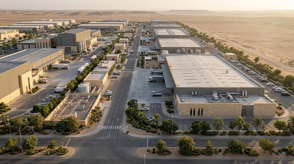 Sites, Routes, and Alternatives
Supporting the project team before making costly decisions
This package serves developers, government entities, PMC and EPC teams, consultants, and contractors who need a unified vision of environmental aspects from feasibility study to implementation and monitoring. The actual scope is determined after reviewing the project type, location, stage, and available data.
- Transforming environmental requirements into a clear workflow and trackable deadlines.
- Uncovering environmental constraints and sensitivities before finalizing the site, route, or design.
- Identifying required studies and surveys and avoiding the collection of data that does not serve the project's decision.
- Aligning environmental risks and deliverables with design, procurement, and the master schedule.
- Unifying environmental inputs among management, designers, contractors, and stakeholders.
Scope of mega projects and infrastructure services
Not every project requires all of the following services. The track and deliverables are selected according to the stage, sector, location, classification, available data, and requirements of relevant authorities.
01Regulatory strategy, permits, and approvals
Regulatory requirements and environmental permitting strategy
Defining the regulatory path, requirements, studies, and potential submissions according to the project type, stage, and location.
Support for environmental activity and project classification
Reviewing project data and supporting the determination of the environmental classification and associated requirements prior to initiating application procedures.
Stakeholder and agency coordination plan
Identifying relevant authorities, points of contact, submissions, and the sequence of coordination during project stages.
Integrated environmental approvals schedule
Converting studies, submissions, and reviews into milestones linked to the main project schedule.
Key deliverables: Requirements matrix, permit roadmap, stakeholder matrix, and environmental approvals schedule.
02GIS, Environmental Constraints, Site Selection, and Routing
Analysis and Mapping of Environmental Constraints Using GIS
Integrating environmental and spatial data to identify sensitive areas, constraints, and risks affecting project planning.
Environmental Screening for Corridors and Routes
Evaluating road, railway, pipeline, power line, and utility routes from an early environmental perspective.
Environmental Assessment of Alternatives
Comparing sites, routes, and design alternatives using verifiable and auditable criteria.
Key deliverables: Environmental constraints map, GIS database, corridor screening matrix, and alternatives evaluation matrix.
03Risk, EIA Scoping, and Cumulative Impacts
Preparation of the Preliminary Environmental Risk Register
Identifying early risks, their causes, impacts, significance, responsibilities, and required mitigation measures.
EIA Scoping and Terms of Reference
Defining key issues, study areas, data, surveys, and methodologies that the study must address.
Initial Cumulative Impact Screening
Checking the likelihood of project impacts overlapping with other projects and activities within the relevant spatial and temporal scope.
Gap Analysis against IFC and GIIP
Comparing project requirements and outputs with Good International Industry Practice (GIIP) and identifying gaps and actions.
Key deliverables: Risk Register, Scoping Matrix, Data Gap Register, Cumulative Impact Screening, and IFC/GIIP Gap Register.
04Biodiversity, Habitats, and Sensitive Areas
Biodiversity Desk Review
Reviewing available data on species, habitats, and environmental records in and around the project area.
Inspect protected and sensitive areas
Determine the spatial relationship between the project and protected areas, habitats, and environmentally sensitive areas.
Preliminary natural habitat maps
Prepare a preliminary visualization of habitat types to support survey design and identify priority areas.
Seasonal survey program design
Determine the types, seasons, locations, methodologies, and duration of surveys according to the nature of the project.
Key deliverables: Review of biodiversity, sensitive areas map, preliminary habitat map, and seasonal survey program.
05Environmental Baseline Studies and Programs
Ambient air quality baseline
Design a program that determines the baseline status of air quality according to the nature of the site and potential sources.
Noise and vibration baseline
Determine current levels and sensitive receptors before the start of construction or operation.
Soil and groundwater baseline
Characterize the baseline status and determine the need for sampling and analysis according to site risks.
Surface water and wadi baseline
Assess streams, wadis, and surface water and their relationship to the project and potential sources of impact.
Key deliverables: Monitoring plan, sampling locations, measurement data, laboratory results where applicable, and GIS monitoring maps.
06Water, floods, pollution, and coastal restrictions
Assessment of the intersection between flood risks and environmental aspects
Determining the impact of floods, surface runoff, and valleys on environmental components, design, and implementation.
Assessment of potentially contaminated lands
Reviewing past and present site uses, identifying pollution sources, suspect areas, and the need for field investigation.
Examination of coastal and marine constraints
Identifying sensitivities and constraints related to ports, coastal facilities, and marine infrastructure.
Key deliverables: Flood-environment intersection log, potential contamination map, preliminary conceptual site model, and coastal and marine constraints map.
07Waste, Carbon, Climate, and Resilience
Project Waste Management Strategy
Projecting waste types and quantities, and determining principles for reduction, sorting, reuse, recycling, and management across phases.
Carbon and Greenhouse Gas Baseline
Identifying emission sources and establishing a baseline to facilitate comparison and build future reduction measures.
Climate Risk and Climate Resilience Assessment
Identifying climate risks associated with the site, assets, and operations, and developing adaptation and resilience measures.
Key deliverables: Waste strategy, carbon and greenhouse gas baseline, and climate and resilience risk log.
When to start environmental services during the project lifecycle?
The scope of environmental support changes as the project transitions from feasibility to implementation. Starting early allows for modifying the location, route, and design before high-cost decisions are locked in.
What does the project team receive?
Outputs are designed to serve management, designers, PMC teams, EPCs, and contractors, rather than being isolated reports detached from project decisions.
Sectors Benefiting from the Package
An Integrated Methodology for Environmental Pathway Management
The mission moves through an interconnected chain, with scope, risks, and deliverables updated as project data and design evolve.
Structured technical work and deliverables tied to project reality
Specializations, methodologies, and surveys are determined according to the project scope, available data, and applicable requirements at the time of execution, while clarifying assumptions, evaluation limits, and the responsibilities of the parties.
- Specific scope of work, deliverables, and required data prior to execution.
- Linking results to risks, design, and the project schedule.
- Technical review for consistency between data, analysis, and recommendations.
- Updating the regulatory and technical reference according to the project status at the time of the task.
Frequently Asked Questions about Environmental Planning for Major Projects
When is the best time to start environmental planning for a project?
It is best to start during the feasibility study or site and route selection phase, and before approving the conceptual design, so that constraints can be addressed and alternatives evaluated before locking in high-cost decisions.
Does every project need all 25 services?
No. The necessary services are determined only after reviewing the sector, location, phase, classification, alternatives, available data, and the requirements of relevant authorities.
What data is required for the initial review?
Project description, type, location, phase, area or route length, plans, alternatives, master schedule, available studies and permits, and any lender requirements.
Does the service include the analysis of alternative routes and sites?
It can include corridor screening, GIS constraint analysis, environmental assessment of alternatives, preparation of a comparison matrix, and inputs to help the project team select the preferred alternative.
What is the difference between baseline studies and an Environmental Impact Assessment (EIA)?
Baseline studies describe the reference environmental condition prior to the project, whereas an EIA uses this data along with project details to assess impacts, alternatives, mitigation measures, and monitoring.
Can approvals be linked to the project master schedule?
Yes, a schedule can be prepared linking studies, submissions, reviews, and approvals to key milestones and environmental stop points within the project schedule.
Does the service guarantee the issuance of the permit or approval?
No. The service helps identify requirements, prepare deliverables, and support technical reviews, while the final decision and acceptance requirements remain with the relevant regulatory authority.
Are you planning a major project or infrastructure corridor?
Send the project type, phase, location, and available master plans or KML and KMZ files, and we will review the preliminary data to determine the appropriate path, services, and deliverables.
Document preparation and technical support do not constitute a guarantee for issuing a permit or approval; the final decision and final requirements fall under the jurisdiction of the competent regulatory authority.